YOU Take US There, Week 9
Forerunner 305: Invaluable Aid in a Crisis

I was coming back from what felt like a typical morning run, although I felt unusually tired, which I attributed to the heat and humidity of Virginia. Having traveled from Connecticut two days before, I was still not properly acclimated, but I thought I could complete my weekly long run by starting early, carrying plenty of water, and stopping frequently for walk breaks. Coming home, I broke my pace and faced three questions that surfaced over a period of several minutes:
• Why do I have cuts on my hands and arms?
• Why is there a fine layer of dirt in my mouth and in my hair?
• Why am I running along Route 50, a major road that I usually only cross?
This was not the first time I had gone out for a run, passed out, and experienced amnesia. Almost precisely a year ago, I had gone out for a summer morning run and awoken in an ambulance, having evidently fainted and then talked with a police officer called to investigate why I was lying down beside the road. That alarming episode had led to a visit to a cardiologist and a neurologist, both whom gave me a clean bill of health. The following year, I had continued to run virtually every day, usually logging more than 35 miles each week, and completing a 5K, several 10K’s, a half-marathon, and my first marathon with no significant problems. Now once again, I was faced with an unexpected crisis and a mystery that led me back to doctors and specialists. This time, though, I was considerably aided because I had been wearing my new running toy: a Garmin Forerunner 305.
I admit to being a gadget junkie. Since I was originally attracted to running for its simplicity, I sometimes reflect with wry irony on my collection of paraphernalia: wicking shorts and shirts, winter tights, a Gore-Tex jacket, Buff headgear, and of course my I-Pod. The Garmin seemed the most self-indulgent gadget, but I could not resist the data generated by a nifty device that could give me my distance, heartbeat, lap pace and enable me to liven up my runs by programming workouts and racing myself on specific courses. What I did not anticipate is how important all this data would be.
Once I had made it back home and recovered, I started my investigation in Garmin’s Training Center software. There, I quickly figured out that my run had halted 2.8 miles from my start. In my car, I followed my course for that distance and was not entirely surprised to find my headband by the side of the road. I also checked out my heart rate and speed, which was conveniently broken down by mile laps. My fall was clearly indicated, but there was no clear reason; everything seemed to be going fine. Still, this gave me some information for my visit to a cardiologist, who studied the graphs and tables with considerable interest before checking out my heart. Just like last year, nothing was clearly wrong.
My primary physician had also set up an appointment with a neurologist, and the day before my meeting I remembered my MotionBased account, which I had neglected for several weeks. Once I uploaded the data, I gathered some more relevant and important information. I had been stationary for five minutes, considerably longer than I had guessed. I also discovered that, while the humidity was high that morning, the temperature never exceeded the 70’s, which cast doubt on the theory that I had collapsed because of the heat.
Most revealing, though, was the review of the run on MotionBased new Map Player. While I had seen the outline of the run on Training Center, rural roads were not indicated on the software’s map. It was while watching the MotionBased simulation over a week later that I realized that not only had I run along Route 50 on my way home, but for a short distance after the fall I had gone the opposite way on this major road – East towards Washington instead of West towards my house. Normally, I would avoid running on this road at all, and I would never follow it East. Clearly, I had been extremely disoriented.
This information, accessible on the Web, was of interest not only to me, but also to the neurologist who tested me. Like the cardiologist, she was amazed by the amount of information and specific data I was able to generate, especially about a section of a run that was of particular interest because I could not remember it. My Forerunner essentially eliminated significant possibilities: a significant problem was documented, but it was not caused by high temperatures, too fast a pace, or too elevated a heartbeat. Along with the tests of my heart and brain, which cleared a cardiac event or an epileptic attack, the most likely cause was clearly dehydration which, combined with high humidity, led to heat exhaustion. And the prognosis was clear too: I could continue to run, but only by carefully monitoring my hydration levels and the humidity outside.
Having gone through an almost identical crisis a year ago, it is very clear to me how much it helped to be wearing a Garmin. I chose the 305 because it seemed to me to be the best training product on the market for a runner, providing a great deal of data in flexible formats designed to support almost any training program. What I did not anticipate was how invaluable this same data would prove to be in coping with an unexpected crisis that no runner wants to face.
Hunt L.
Middleburg, VA
Off-Road

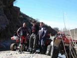
 One of many trips using may eTrex Legend to get us there and back. This trip is in Arizona from Lake pleasant to Bradshaw’s grave and the Hassayampa River.
Thanks
for all the help finding places that were very difficult to find.I used
topo maps for years and it was much slower and some times almost
impossible to find places without a GPS. The trackback feature made
the return to our trucks very easy and a much more enjoyable and with
no wrong turns.
Mike M.
Peoria, AZ
Find: Harley-Davidson Dealerships

For my birthday in May, my wife Karen and I took a road trip from Atlanta, GA to Ft. Lauderdale, FL. This sort of drive is common for many people, but instead of taking one vehicle, we took two. I on my Harley-Davidson motorcycle and she in the car. Along the way, I wanted to visit as many Harley dealers to pick up a t-shirt or pin as a way of commemorating the trip. To do this, I used my Garmin Quest to create routes from our house to the hotel in Ft. Lauderdale and back but to find the dealers, I used a waypoint file that I created that contains the location of every Harley-Davidson dealership in the continental US, Alaska and Hawaii.
The file has well over 800 entries and was input using data from Harley’s website and Garmin’s MapSource program. I have made this file available for free to anyone that wants to use it for their own Garmin GPS receivers. The trip has been chronicled in my blog. Along the way, we stopped at 14 dealerships, 11 were open and all but about two were exactly where the Quest said they’d be. I blame Harley’s data for the missing ones :). As we drove along the interstate, the Quest kept track of where the next dealer was and guided me flawlessly to it, making it seem like I lived in the area and knew exactly where I was going. And, as a testament to it’s reliability, I got caught in a torrential downpour just south of Orlando, FL with no shelter along the highway so I had to wait it out on the side of the road with the uncovered bike and everything on it getting drenched, including the Quest. When the rains ended about 10 minutes later, the Quest fired right back up and performed as if nothing had happened.
After getting and installing the Quest on the bike, I don’t know how I ever got along without it. I have a handlebar mount that allows me to use it on battery power on the bike then transfer it to the car when I need to. I always get questions from other bikers when they see the Quest and when they see what it can do, they look at their paper maps and just shake their heads. It even saved my engine from overheating when I was stuck in traffic one hot afternoon. I told it to find me a detour from my current location and it re-routed me off the road I was on, through a subdivision, then back out to another main road and on to my destination, keeping me out of the stop-and-go mess. I’m going to be upgrading my automotive GPS to a StreePilot 2820 very soon and will also be getting a GPSMAP 60CSx to take with us on our next big vacation, a cruise among the Greek Isles and Egypt where we’ll be riding camels and jeeps in the desert at the Great Pyramids. I’ll be interested in seeing the tracks created from that trip.
Drew C.
Suwanee, GA
Geo-Vacations

It seems that in any hobby, sport or activity there are people that are brand loyal. I would say without reservation we definitely fit that description when it comes to GPS’s. We began our love of Garmins back in 2002 when we stumbled onto this crazy thing called geocaching. I was just looking around online and I saw this geocaching link. I clicked on it and it looked like something that we needed to try. I mentioned it to my wife and she thought it sounded like fun even though she was a bit skeptical when I mentioned a GPS. Her skepticism was due to the fact that I already previously owned two other GPS’s and we never really used them because of being complicated and far from user friendly. I will be kind and not mention the brand, but rest assured they weren’t Garmins.
Okay, so I sweet talked her into buying a basic yellow Etrex and I was amazed how simple yet extremely functional this little GPS was. It had a feel and design that just made it feel like it belonged in your hand. The next day we headed for our first geocache and quite honestly we never expected we would actually find it. I still remember my wife poking a stick in a brushpile and we heard a sound that now is all too familiar. Her stick poked an ammo can. We had found our first cache. Here we are 4 years later and have found about 950 caches. Each one is just as fun as our first. We were hooked on geocaching and we were hooked on Garmins. We have owed six Garmins since then including the basic yellow Etrex, Legend, Vistas, StreetPilot III and the StreetPilot 2610.
Recently we took a vacation to South Dakota and Wyoming and we don’t go anywhere without doing a little geocaching. As we packed our luggage we made sure there was room for our Vista, Legend and the 2610. As we went thru security at the airport we fully expected our luggage to end up in the hands of the bomb squad. It had to look very suspicious with 2 Etrex’s, a 2610, tripod, countless chargers, PDA and cameras. I wish we could have looked at that x-ray. Oddly enough we got right thru, I guess they figured we were harmless geocachers.
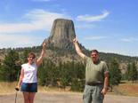
Our trip to Wyoming and South Dakota was fantastic. There is no question that geocaching and our Garmins showed us places that the normal tourist would never see. Our thanks to Garmin for a great product and Groundspeak for a fantastic site and many adventures. The included photo shows my wife and I with our Garmins in hand with Devil’s Tower in the background. Well, gotta go, there’s so many places to explore.
Tom D.
Kersey, PA
A Customer For Life

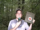
Hello my friends I LOVE YOUR PRODUCT !!! I bought the Garmin eTrex Venture and I use it for Geocaching I just love how easy it is to use. I then bought the Garmin StreetPilot c330 and since I have owned it I have not gotten lost one time and I drive 25,000 miles a year. I wanted to buy another GPS for Geocaching so I wanted to try another product, to see if I would like it, I bought the magellan Explorist 210. I had it for two days and hated it, it was just to hard to use and the accuracy was not as good as my Venture. So I will save my money and buy the eTrex Venture Cx. Thanks again for a great product. I’m a customer for life!!! Attached is a picture of me in the pouring rain Geocaching , and I had no problem with my Venture.
Rance Howard
Fishkill, NY
The post YOU Take US There, Week 9 appeared first on Garmin Blog.
Sample Block Quote
Praesent vestibulum congue tellus at fringilla. Curabitur vitae semper sem, eu convallis est. Cras felis nunc commodo loremous convallis vitae interdum non nisl. Maecenas ac est sit amet augue pharetra convallis nec danos.
Sample Paragraph Text
Praesent vestibulum congue tellus at fringilla. Curabitur vitae semper sem, eu convallis est. Cras felis nunc commodo eu convallis vitae interdum non nisl. Maecenas ac est sit amet augue pharetra convallis nec danos dui.
Cras suscipit quam et turpis eleifend vitae malesuada magna congue. Damus id ullamcorper neque. Sed vitae mi a mi pretium aliquet ac sed elitos. Pellentesque nulla eros accumsan quis justo at tincidunt lobortis denimes loremous. Suspendisse vestibulum lectus in lectus volutpat, ut dapibus purus pulvinar. Vestibulum sit amet auctor ipsum.

