Weekly Winners: YOU Take US There, Week 10
A Bite of Americana
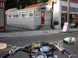 One of the ways I use my Garmin StreetPilot 2610 is to locate Diners of the past and ride to them on my Kawi Nomad. I have been to diners from Rumford, ME to New London, CT to Brattleboro, VT. Of course one of the objectives is to find the greatest roads to travel in NE on a motorcycle and I have found some gems.
I have created a waypoint base file in MapSource, which includes well over 100 diners in the New England area. The source of these waypoints includes research on the internet and within MapSource itself using the find functions. This past Saturday I visited over 30 diners along the coast of Connecticut. I could not have possibly accomplished this adventure without my Garmin. Each diner was plugged into MapSource and became a via points as part of route I planned.
A funny moment on this journey directed me to a residential neighborhood, which I said to
myself this can’t possibly be correct. There was this gentleman outside his home sweeping his driveway, so I stopped and asked if he knew where the Royal Diner was. He said of course I know where it is. After a brief pause in the conversation, I asked, “where is it”. He said, “you are looking at it”. I was very much confused. He then went on to explain that he was the owner of the Royal Diner, sold the diner and this location was now the official corporate location for tax purposes. We talked diners for a bit, how they are becoming extinct and other such nostalgic yaddi yas. Was I disappointed that my 2610 directed me here. Absolutely not, how else could I have met this great guy. It is not just the destination, but the adventure getting there.
I have pretty much conquered New England for classic diners and next on my quest are PA and NJ. So if you see a blue Nomad with a dragon on the right lower bag, you can bet it is me waiting to hear “via point on the right in 1.2 miles” coming from my Garmin
Bill C.
Uxbridge, MA
No More Guessing
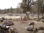
I’ve taken up the hobby of geocaching, and enjoy finding caches in the places we visit. At time, a certain cache that has a view or provides a nice hike will determine where we go or how we spend our time. This past Christmas, I received a Garmin GPSMAP 60C as a gift – what a gift it has been. With the MapSource software and auto-routing capabilities, we’ve been able to easily locate the places where we want to cache – no more guessing, no more pulling out multiple maps, and no more getting lost!
Confident that our GPS will get us where we want, we’ve been able to get out into the wild and enjoy some stunningly beautiful areas and views. And a really cool cemetery outside of Sisters, OR where this particular grave site was designed as an old cowboy campfire – see the cowboy hat hanging on the wooden head piece?
Jen B.
Eugene, OR
Crash Testing With Garmin
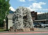
In July 2003, I loaded my GPS III up with a 10 day trip. I had my Harley shipped to Las Vegas Harley Davidson from Virginia, grabbed my tickets and met my bike at the dealership to begin my journey to Sturgis Motorcycle Rally in South Dakota, “The Long Way”. I had owned my GPS III for a couple of years and was confident in it’s capabilities. I had the routes divided into 8 riding day’s with a day of sight seeing / geocaching between some of the days.
Day 1- Vegas-Hoover Dam-Grand Canyo; Day 2- Grand Canyon-Monument Valley-Four; Corners-Cortez,Colorado; Day 3- Cortez,Co.-Arches National Park-Moab Utah; Day 4- Moab,Utah-Rock Springs Wyoming; Day 5- Rock Springs Wyoming-Jackson Hole Wyoming-Grand Tetons-Yellowstone National Park; Day 6- Yellowstone-Silvergate,Montana; Day 7- Silvergate, Montana-Beartooth Pass-Sheridan Wyoming; Day 8- Sheridan Wy. Sturgis SD.
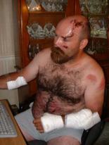
In these day’s of riding I felt I could be the road tester for Garmin. I had experienced 125 degree temps in Moab, 60 MPH+ sand storm in Four Corners and below freezing temps on Beartooth and even adjusted the carburetor on my Harley for the high altitudes by using the altitude readings from my Garmin III. Some just a few hours apart. It was awesome. I even crash tested the Garmin. Yes, crash tested. Aug 2nd 2003 about 5:00 in the evening. I was on Hwy 24 near Lovell,Wyoming just putting on miles during riding Day 7 of my trip. It was 105 degrees when an antelope decided he wanted to cross the road about 40 mph. I hit him right behind the right shoulder and he whipped around the left side of the motorcycle, under the rear tire and put us up on the front tire and over the handlebars at 70 mph. I’m pretty sure that the handlebar mount for the GPS III was for bicycles but it fit and I used it. After 10 days +/- in the hospital,250+ stitches,scalding burns and road-rash from ! the asp halt,many stitches and a knee replacement for my girlfriend, we limped to an airport in Billings,Montana from there we went to my girlfriends house in Delaware via Phoenix to heal. my motorcycle arrived @ Mikes Famous Harley Davidson in Wilmington Delaware a few weeks later. The bike had $9000+ damage to it and amazingly enough my GPS III was still on the handle bars. It was a bright point in the pain filled weeks I had just experienced. I put in some fresh batteries in my GPS III and it worked as flawlessly as it did before the crash,It still works today. I upgraded to a GPS V a few years ago and will probably buy a zumo in the coming months. As for road-testing Garmins, I am available but I have to draw the line at the crash testing.
Dave T.
Manassas, VA
The Best Purchase
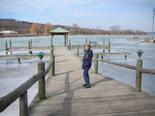
Our Garmin GPSMAP 76CS has to be the best consumer electronics purchase we have ever made! The freedom it gives us to drive anywhere on any road no matter how small and then be able to get to another destination is just amazing. We no longer have to try and remember if we need to turn here or there. Our 76CS with its auto-routing teamed with City Select v7 get us there and back. We also have an eTrex Vista C that we use for Geocaching. Our GPS’s have taken us to places that we would have never experienced!
Barb and Tom B.
Montoursville, PA
Riding 4,500 Miles
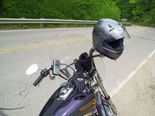
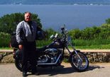
Last Spring, Max, my “04 Harley Davidson Dyna Wide Glide, and I went on a ride from our home near Denver to visit my brothers in Minnesota and Wisconsin. Having never been a fan of the “super slab” for motorcycling, I longed for a trip traveled as much as possible on paved county roads and state highways.
In addition, I wanted to find the “most scenic” route between here and there. Using Garmin software on my PC and recommendations about “the best motorcycling roads” from the web, I was able to plot a route across Colorado, Nebraska, Iowa, Minnesota and Wisconsin almost entirely on two lane blacktop. The route incorporated lots of “most scenic” and “twisty” roads linked by county and state byways. I downloaded the turn by turn route into my Garmin GPSMAP 76CS and we hit the road.
My Garmin GPSMAP 76CS kept us on track the entire way, even when turning from county road to county road out on the great plains and thru the hills of Wisconsin. We roared along mile after mile of smooth, empty, two lane black-top. Mostly “deserted” road; just Max and me and grass and trees and sky. What a delight!
Being off the interstate, we hardly ever had any traffic to deal with. Especially in the rain, the lack of “high-balling” semi’s was wonderful. The GPS never blinked, never faltered. Thru heat ( the thermometer on a local bank flashed 103 degrees as we rode past on the first afternoon), vibration (see below about rough roads) and rain (3 days worth) it kept telling me when and where to turn. The directions were especially useful in the couple of places where there were no signs.
Of course, traveling like this doesn’t get you across the country in a hurry. It’s not for anyone who has to meet a deadline. Many days we put on less than 300 miles before coming to a small town just right for looking over. With the luxury of no set schedule and the freedom of always knowing the way with the GPS, I think we rediscovered travel the way it should be.
Once when we broken down with a split drive belt ( my fault for taking us on freshly applied seal-coat and gravel), I was able to tell our rescuers from Harley Davidson exactly where we were and how to get to us just by checking on the Garmin. I wouldn’t think of cruising without it.
A word to the wise to my fellow motorcycle cruisers “if you come upon freshly applied tar and gravel patches- DO NOT PROCEED-! TURN AROUND! There is no way to miss the goo! If you have a Garmin it will be easy to find a detour to miss the mess. In all, Max and I logged over 4500 miles in three weeks of riding and visiting. We anticipate many, many more trips just like it
I’ve included a couple of pictures of Max and me on the road. You can see that the handlebar mount was less than ideally placed. In the interim, I’ve acquired a RAM Mount set that positions the GPS directly in front of me, pointing along our direction of travel. Of special note is the very handy speedometer incorporated into the data page on the 76CS. Since the GPS unit is now located directly in front of me, just below my normal line of sight when riding, I don’t have to take my eyes off the road to look all the way down to the stock speedo ( located on the tank). You might think about designing a mount that will put your new product directly in front of the rider instead of off to the side.
Alan S.
Lone Tree, CO
The post Weekly Winners: YOU Take US There, Week 10 appeared first on Garmin Blog.
Sample Block Quote
Praesent vestibulum congue tellus at fringilla. Curabitur vitae semper sem, eu convallis est. Cras felis nunc commodo loremous convallis vitae interdum non nisl. Maecenas ac est sit amet augue pharetra convallis nec danos.
Sample Paragraph Text
Praesent vestibulum congue tellus at fringilla. Curabitur vitae semper sem, eu convallis est. Cras felis nunc commodo eu convallis vitae interdum non nisl. Maecenas ac est sit amet augue pharetra convallis nec danos dui.
Cras suscipit quam et turpis eleifend vitae malesuada magna congue. Damus id ullamcorper neque. Sed vitae mi a mi pretium aliquet ac sed elitos. Pellentesque nulla eros accumsan quis justo at tincidunt lobortis denimes loremous. Suspendisse vestibulum lectus in lectus volutpat, ut dapibus purus pulvinar. Vestibulum sit amet auctor ipsum.

