Victor’s Vectors: FliteCharts or ChartView?
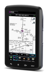
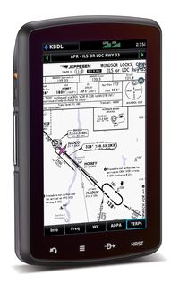
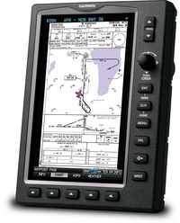
Several people must have been very good last year because Santa delivered several new Garmin  aviation GPS units this Christmas. Those happy recipients have been calling and asking all kinds of questions about their new toys. One question that I have heard a couple of times is about the differences in using Garmin FliteCharts compared to using Garmin ChartView Powered by Jeppesen for the GPSMAP 696/695 and aera 796/795.
FliteCharts is Garmin’s default charting product and is preloaded in the GPS from the factory. The information looks the same as the AeroNav approach plates from the FAA and has a geo-referencing feature which puts an aircraft icon on the chart at your location. The FliteCharts database is currently only available for the United States.
The GPSMAP 696/695 and aera 796/795 are also capable of using the ChartView feature which will allow the GPS to use and display the Jeppesen plates. This does require the purchasing of an unlock key ($499) for the specific GPS through an account at www.flyGarmin.com. After purchasing the unlock key it is downloaded to an SD card and then placed in the GPS SD card slot. The Jeppesen plates also have the geo-referencing feature and are downloaded from Jeppesen to an SD card.
 So which should you go with? Well, it really comes down to two points. First, which version of the charts are you most familiar with? I know several pilots that will only fly with Jeppesen’s plates, however I personally use FliteCharts because the government’s plates are what I’ve always used. Secondly, do you fly outside of the United States? If the answer is "yes" and you want the approach plates on
 your GPS then the answer is the ChartView feature because as I mentioned FliteCharts only has US coverage. If your answer is "no", then really it comes down to your personal preference and whether or not you want to pay the upgrade cost to unlock the ChartView. I hope that provides enough information to help you each make your own decision on which charting product to use. Either way you go, enjoy those new toys and have a safe flight!
The post Victor’s Vectors: FliteCharts or ChartView? appeared first on Garmin Blog.
Sample Block Quote
Praesent vestibulum congue tellus at fringilla. Curabitur vitae semper sem, eu convallis est. Cras felis nunc commodo loremous convallis vitae interdum non nisl. Maecenas ac est sit amet augue pharetra convallis nec danos.
Sample Paragraph Text
Praesent vestibulum congue tellus at fringilla. Curabitur vitae semper sem, eu convallis est. Cras felis nunc commodo eu convallis vitae interdum non nisl. Maecenas ac est sit amet augue pharetra convallis nec danos dui.
Cras suscipit quam et turpis eleifend vitae malesuada magna congue. Damus id ullamcorper neque. Sed vitae mi a mi pretium aliquet ac sed elitos. Pellentesque nulla eros accumsan quis justo at tincidunt lobortis denimes loremous. Suspendisse vestibulum lectus in lectus volutpat, ut dapibus purus pulvinar. Vestibulum sit amet auctor ipsum.

