Weekly Winners: YOU Take US There, Week 12
It’s Not About Finding the
Cache…
…It’s about finding your daughters. I have three daughters all in middle school who are all grown up at the age of 11 to 13. Recently I purchased a Garmin GPSMAP 60CSx for business and found out that my girls love looking for hidden treasures. First I had to convince them to go with me looking for geocaches, but it quickly turned into them asking me to take each of them out searching for ammo boxes and Altoids tins. Soon we started going out on a hike at all times of the day (and night) and with no TV, IPOD, Gameboy, xbox, instant messager, cellphone or Radio we talked between waypoints.
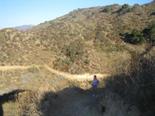
Regardless if we located the cache or not, I found out about their dreams and fears. What they like and hate. I found out about friends, school, all sorts of growing up stuff. Interesting I bought a GPS to help me find locations when I travel, but what I really found was my children. I have about a 50 photos of each of my girls searching for treasures – what this photo shows is a long and endless trail with nothing to do but talk. Which turns out to be the best Cache of all.
Greg L.
Simi, CA
A Golden Anniversary
My wife and I left Maine for our 50th wedding anniversary on June 16, 2006 and returned 9,000 miles later. We arrived back in Maine on August 8. I had another GPS program that I used and got lost many times. There was anger from my wife for not taking the correct route. On my way back from Washington state, I stopped in Ft. Knox, Kentucky and bought a StreetPilot c330. At about the same time I had a major electrical problem with my van. I lost the brake lights, turn signals, gas gauge went to zero as well as the speedometer. With the help of the Garmin, we arrived safely. It showed us the speed, so no tickets, the mileage which helped me know how much fuel that I had left. But most of all, we did not go off course once. I also stopped in Rest Areas and got the phone numbers from local motels and using my cell phone called a number of them to get the lowest price. This saved me a lot of money, thanks to Garmin. Also when we arrived in Maine, I removed the GPS and planted a big kiss on it and said, “Thank you Lady, you saved my life”. I could not believe how accurate it was, there is no way possible to get lost with the Garmin. I was in Circuit City this morning and overheard a salesman trying to explain the GPS. I asked if I could say something. When I got done, the customer bought one. He was here in Maine and on his way home to New York. I told him and his wife I had no reason to lie for I do not work there and am only a customer. I use the Garmin daily even in my small hometown for I am so amazed with it.
Larry D.
Richmond, ME
The Cycling Edge
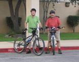
Cycling has changed my life
and the lives of many others I know and ride with. My Garmin Edge 305HR
has faithfully recorded every detail of my road and mountain bike rides as I
cycle my way to better health. I upload the data to Motionbased.com and
regularly write-up my ride experiences on my new cycling blog.
My cousin Joey joins me for rides and is a real inspiration. He suffered
his second heart attack just a few months ago but is making a great
recovery. He recently broke his mileage record by biking more than 23
miles and used his bike-mounted Garmin eTrex Legend to record the moment. He
sends me weekly updates by e-mail on his progress via Motionbased.com.
We’ve both found that using a Garmin GPS and Motionbased.com provides an
excellent way for us to record details on our rides, track our performance and
help us set fitness goals. Thank you Garmin!
Justin M.
Instructions? Who Needs Them?
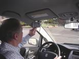 After 25 years of telling other people how to do it as a Sales Manager, I moved to Seattle, Washington and took over as a Territory Manager. As this role includes making sales calls to towns I’m not familiar with, it only took getting lost two times for me to figure out that unless I got some help – I was doomed!
After reading reviews of all the units, I went out and bought a nüvi. In the store parking lot, I plugged it in and entered my home address and touched: Go Home. It took me home. Of course, at this point I hadn’t bothered to read any instructions whatsoever. Later in the week my wife and I drove up to Vancouver, British Columbia. I’d gotten lost up there as well and the nüvi performed beautifully. We found restaurants, a hotel and when I was sure I knew the way, disregarded the instructions and promptly got lost – it even got me back on the right road. I played with the voices. I thought listening to the French voice would be fun, but my French is too rusty to try to translate instructions while driving. I’ve settled on the female Australian English voice. One fun quirk is that Washington Route 99, or as it’s listed on the freeway signs: WA99, is pronounced as “Western Australia 99”!
I think the highest praise came from my wife, who said: “This is really a useful gadget. Can I borrow it on my next trip?” My thanks for producing a great unit. I still haven’t read the instructions.
Richard S.
Shoreline, WA
Atop T-Shirt
Bluff
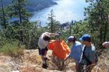
At a turn near the end of the road to Genoa Bay, BC, an unmarked trail starts in the woods at the base of Mt Tzuhalem. Aptly named Ridge Trail, it ascends 1600 feet through pine, oak, and arbutus trees, tiny meadows and rocky patches, up the ridge to the top of Mt Tz. Along the way are spectacular views of Cowichan Bay, Genoa Bay, and Salt Spring Island. The trail has been frequented by my aunt, uncle, and cousins, who live at the end of the road by Genoa Bay. They made a side trail to a rock bluff with a view of their house, and have christened it T-Shirt Bluff. The photo shows what you have to do at T-shirt Bluff to prove you’ve made it. My brother and his 2 kids are dressing a bush. It was very visible from below. We climbed Mt Tz a couple times with my Garmin eTrex Legend, but I had to promise not to publish T-shirt Bluff’s location. I climbed and ran the trail one day, and saved my tracks. Being an engineer, I had to report data. I downloaded my tracks to MapSource, selected the track, right clicked and selected properties. Then I chose a “show profile” button to see a plot of the track profile. You should try it if you’ve never done it. I put a picture of the track profile on my flickr. Now we know the answers to the “how far and how high did you go?” questions.
Tim C.
Omaha, NE
The post Weekly Winners: YOU Take US There, Week 12 appeared first on Garmin Blog.
Sample Block Quote
Praesent vestibulum congue tellus at fringilla. Curabitur vitae semper sem, eu convallis est. Cras felis nunc commodo loremous convallis vitae interdum non nisl. Maecenas ac est sit amet augue pharetra convallis nec danos.
Sample Paragraph Text
Praesent vestibulum congue tellus at fringilla. Curabitur vitae semper sem, eu convallis est. Cras felis nunc commodo eu convallis vitae interdum non nisl. Maecenas ac est sit amet augue pharetra convallis nec danos dui.
Cras suscipit quam et turpis eleifend vitae malesuada magna congue. Damus id ullamcorper neque. Sed vitae mi a mi pretium aliquet ac sed elitos. Pellentesque nulla eros accumsan quis justo at tincidunt lobortis denimes loremous. Suspendisse vestibulum lectus in lectus volutpat, ut dapibus purus pulvinar. Vestibulum sit amet auctor ipsum.

