Update Available for Preloaded Garmin Marine Maps and Charts
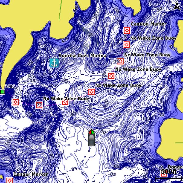
The preloaded maps and charts found on your Garmin marine product just got better! Today an update was announced for the preloaded maps and charts various Garmin marine chartplotter and combination devices. This update applies to the U.S. LakeVü HD maps, Canada LakeVü HD maps and BlueChart g2 coastal U.S. charts.
- Mariners with an echoMAP chartplotter/sonar combo device with preloaded LakeVü HD maps for the U.S. will now have access to 13,000 U.S. HD lakes offered with shore-to-shore 1-foot contours. In addition to a significant increase in the number of inland lakes available, this update also provides much better detail and coverage of popular lakes, including 1-foot contours for the Great Lakes, Lake Simcoe, Rice Lake, Lake Okeechobee and many more. This update is available for the following devices: echoMAP 43dv, 50dv, 50s, 53dv, 70dv, 70s, 73dv, 73sv and 93sv.
- For select GPSMAP series units with both LakeVü HD and BlueChart g2 for coastal U.S., this update also includes Notice to Mariner updates, expanded Explorer chart coverage in the Bahamas and updates for numerous marine service points in North America. This update is available for the following devices: GPSMAP 7600/7600xsv series, and the GPSMAP 547, 547xs, 741, 741xs, 840xs and 1040xs series.
- The preloaded Canada LakeVü HD has also been updated in the echoMAP series, now offering 4,800 HD lakes with shore-to-shore 1-foot contours. This update includes a tremendous amount of shoreline coverage for Manitoba, which provides a better user experience for Garmin’s new Quickdraw Contours software feature. Bathymetry data for Stuart, Trembleur and Takla lakes in British Columbia has also been added, as well as Otter, Drope, Nistowiak and Mountain Lakes in Saskatchewan. This update is available for the following devices: echoMAP 45dv, 55dv, 75dv and 95dv.
- A routine update is also available for echoMAP and GPSMAP customers with preloaded BlueChart g2 coastal U.S. charts that includes Notice to Mariner updates, expanded Explorer chart coverage in the Bahamas and updates for numerous marine service points in North America. This update is available for the following devices: GPSMAP 8208, 8212, 8215, 7212, 7215, 6208, 6212, 5212, 5215, 4208, 4210, 4212; the GPSMAP 440, 440s, 441,441s, 541, 541s, 545, 545s, 546, 546s; the GPSMAP 640, 740, 740s and 78sc; and the echoMAP 44dv, 50dv, 50s, 54dv, 70dv, 70s, 74dv, 74sv and 94sv.
Qualifying customers can use the New Chart Guarantee, which allows for one free update to the newest version of charts when a preloaded chartplotter is purchased. If a customer has already obtained their free update, this update is available for $99.
The post Update Available for Preloaded Garmin Marine Maps and Charts appeared first on Garmin Blog.
Sample Block Quote
Praesent vestibulum congue tellus at fringilla. Curabitur vitae semper sem, eu convallis est. Cras felis nunc commodo loremous convallis vitae interdum non nisl. Maecenas ac est sit amet augue pharetra convallis nec danos.
Sample Paragraph Text
Praesent vestibulum congue tellus at fringilla. Curabitur vitae semper sem, eu convallis est. Cras felis nunc commodo eu convallis vitae interdum non nisl. Maecenas ac est sit amet augue pharetra convallis nec danos dui.
Cras suscipit quam et turpis eleifend vitae malesuada magna congue. Damus id ullamcorper neque. Sed vitae mi a mi pretium aliquet ac sed elitos. Pellentesque nulla eros accumsan quis justo at tincidunt lobortis denimes loremous. Suspendisse vestibulum lectus in lectus volutpat, ut dapibus purus pulvinar. Vestibulum sit amet auctor ipsum.


