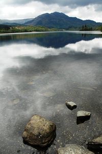
Navigate the lakes with Garmin
 If you’re inland-bound this summer, let Garmin Inland Lakes cartography lead the way. Mariners can now get detailed inland lake coverage for the entire U.S. on a single data card (or via a single download from the Garmin website) for just $139.99. The new 2010 Inland Lakes cartography has everything you need to navigate the lakes and channels like a local, including detailed contour lines for depth guidance, high-definition shoreline and bathymetric detail, aids to navigation, obstacles and hazards, as well as tide stations and predictions. With this single card (or download), you’ll have access to comprehensive coverage of more than 16,500 freshwater bodies of water throughout the U.S., including fishing locations, boat ramps, marinas and local roads and parks. Click here for a complete list of included lakes. And if it’s even more detail you’re after, U.S. Inland Lake Vision is also available as a regional download and includes Autoguidance technology, which suggests the best route to follow, high-resolution satellite imagery, as well as 3D MarinerEye above-water and 3D FishEye below-water views. Inland Lakes Vision is available by West, North Central, Northeast, South Central and Southeast regions.
The post Navigate the lakes with Garmin appeared first on Garmin Blog.
Sample Block Quote
Praesent vestibulum congue tellus at fringilla. Curabitur vitae semper sem, eu convallis est. Cras felis nunc commodo loremous convallis vitae interdum non nisl. Maecenas ac est sit amet augue pharetra convallis nec danos.
Sample Paragraph Text
Praesent vestibulum congue tellus at fringilla. Curabitur vitae semper sem, eu convallis est. Cras felis nunc commodo eu convallis vitae interdum non nisl. Maecenas ac est sit amet augue pharetra convallis nec danos dui.
Cras suscipit quam et turpis eleifend vitae malesuada magna congue. Damus id ullamcorper neque. Sed vitae mi a mi pretium aliquet ac sed elitos. Pellentesque nulla eros accumsan quis justo at tincidunt lobortis denimes loremous. Suspendisse vestibulum lectus in lectus volutpat, ut dapibus purus pulvinar. Vestibulum sit amet auctor ipsum.

