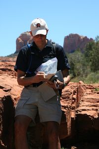
Jake’s Journal: Using BirdsEye Satellite Imagery on your Garmin handheld
 So why BirdsEye? Hunters can easily identify potential tree stand locations, draws, and natural game funnels. Hikers can quickly locate trailheads, campsites, and scenic vistas. Geocachers can better assess terrain difficulty and parking areas close to caches. Even tourists and travelers can navigate amusement parks or historical battlefields like never before.
As you’ll see in the video, the images are among the most highly-detailed available – offering 0.5 meter per pixel resolution in many areas of the United States. Users can also view imagery at every zoom level – from 12 miles to 20 feet – unlike other offerings that force users to stay at pre-determined zoom levels. BirdsEye Satellite Imagery also lets users overlay vector maps, to get a better idea of terrain contours and points of interest.
The post Jake’s Journal: Using BirdsEye Satellite Imagery on your Garmin handheld appeared first on Garmin Blog.
Sample Block Quote
Praesent vestibulum congue tellus at fringilla. Curabitur vitae semper sem, eu convallis est. Cras felis nunc commodo loremous convallis vitae interdum non nisl. Maecenas ac est sit amet augue pharetra convallis nec danos.
Sample Paragraph Text
Praesent vestibulum congue tellus at fringilla. Curabitur vitae semper sem, eu convallis est. Cras felis nunc commodo eu convallis vitae interdum non nisl. Maecenas ac est sit amet augue pharetra convallis nec danos dui.
Cras suscipit quam et turpis eleifend vitae malesuada magna congue. Damus id ullamcorper neque. Sed vitae mi a mi pretium aliquet ac sed elitos. Pellentesque nulla eros accumsan quis justo at tincidunt lobortis denimes loremous. Suspendisse vestibulum lectus in lectus volutpat, ut dapibus purus pulvinar. Vestibulum sit amet auctor ipsum.

