CycleWorld Trek


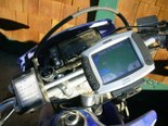
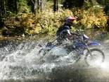
 The event was an excellent opportunity for us to field test zūmo and Quest, while providing hands on demos and instruction to Trek participants. Notice the roll chart in the first picture – this is the normal method for off-road navigation, using multiple trip computers (odometers) on the bike to follow a given route – a very crude and error-prone routing method.

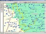
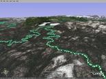
 They were very impressed with a MapSource review of the first day’s track log, showing 152 miles covered in 9 hours, with 6,500 feet of elevation gain. We overlayed that same tracklog into Google Earth and MotionBased.com — we told you zūmo was versatile!
The post CycleWorld Trek appeared first on Garmin Blog.
Sample Block Quote
Praesent vestibulum congue tellus at fringilla. Curabitur vitae semper sem, eu convallis est. Cras felis nunc commodo loremous convallis vitae interdum non nisl. Maecenas ac est sit amet augue pharetra convallis nec danos.
Sample Paragraph Text
Praesent vestibulum congue tellus at fringilla. Curabitur vitae semper sem, eu convallis est. Cras felis nunc commodo eu convallis vitae interdum non nisl. Maecenas ac est sit amet augue pharetra convallis nec danos dui.
Cras suscipit quam et turpis eleifend vitae malesuada magna congue. Damus id ullamcorper neque. Sed vitae mi a mi pretium aliquet ac sed elitos. Pellentesque nulla eros accumsan quis justo at tincidunt lobortis denimes loremous. Suspendisse vestibulum lectus in lectus volutpat, ut dapibus purus pulvinar. Vestibulum sit amet auctor ipsum.

