Create or Improve Existing Fishing Maps with New Quickdraw Contours
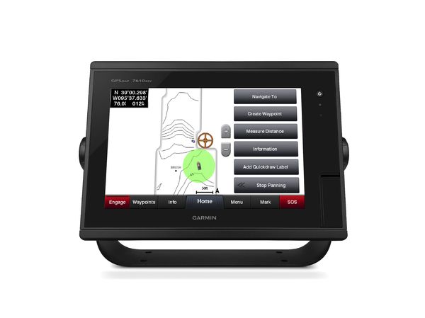
Garmin Quickdraw Contours is a new free and easy-to-use software feature that lets mariners instantly create personalized HD fishing maps with 1-foot contours on any body of water. Quickdraw Contours results appear instantly on a compatible Garmin sonar-enabled chartplotter and the maps can be kept private or shared with others at no cost.
“This is a great way to supplement Garmin mapping options and improve your time on the water,” said Dan Bartel, Garmin vice president of worldwide sales. “With Quickdraw Contours, you’ll no longer have to worry about not having coverage of your local lake or body of water. And while the data is being collected, your system will tell you where you’ve been so you can be confident you’re getting the most comprehensive coverage.”
Quickdraw Contours is powerfully simple. Once it’s turned on, users will instantly see contours with labels generated right on the screen as the boat moves – there’s no waiting around or sending the files to Garmin. The results are quick and accurate, and can be viewed in real-time, or created in the background for use at a later time. For the most comprehensive coverage, Quickdraw Contours clearly shows where usable depth information has been collected and where gaps exist, so users can easily see what still needs to be collected.
To further customize and tailor the data to meet customer needs, Quickdraw Contours also offers user-generated points of interest (POI) and waypoints. The POIs can be used to notate interesting information about a particular location, and waypoints can be added to mark a favorite spot or notable location for future reference.
The collected data can be stored on any off-the-shelf SD or microSD card, as well as existing Garmin BlueChart g2, BlueChart g2 Vision and LakeVü HD Ultra cards. Once the Quickdraw Contours data has been collected, users can opt to share it with others simply by copying the files to another card, or they can choose to keep it private; Garmin does not require that the data be shared, nor is there a fee to keep it private.
This software feature will come standard on the new 2016 echoMAP CHIRP products, and will be available as a free software update for all other echoMAP and many GPSMAP series products. It can be used with any depth transducer, including Garmin Panoptix, HD-ID, DownVü, and NMEA 2000 transducers. To learn more about Quickdraw Contours and all of the 2016 Garmin marine products, visit garmin.com/marine2016.
The post Create or Improve Existing Fishing Maps with New Quickdraw Contours appeared first on Garmin Blog.
Sample Block Quote
Praesent vestibulum congue tellus at fringilla. Curabitur vitae semper sem, eu convallis est. Cras felis nunc commodo loremous convallis vitae interdum non nisl. Maecenas ac est sit amet augue pharetra convallis nec danos.
Sample Paragraph Text
Praesent vestibulum congue tellus at fringilla. Curabitur vitae semper sem, eu convallis est. Cras felis nunc commodo eu convallis vitae interdum non nisl. Maecenas ac est sit amet augue pharetra convallis nec danos dui.
Cras suscipit quam et turpis eleifend vitae malesuada magna congue. Damus id ullamcorper neque. Sed vitae mi a mi pretium aliquet ac sed elitos. Pellentesque nulla eros accumsan quis justo at tincidunt lobortis denimes loremous. Suspendisse vestibulum lectus in lectus volutpat, ut dapibus purus pulvinar. Vestibulum sit amet auctor ipsum.
